
Beng Mealea
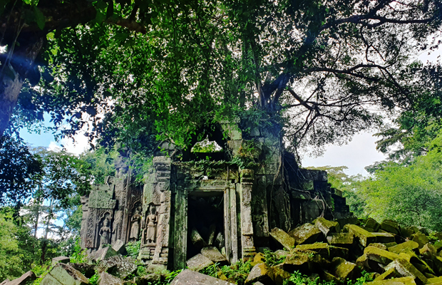
Beng Mealea is one of the ruins in the Angkor archaeological site, where the rubble of stones is still covered by the tropical forest. This twelfth-century structure lies within a chaotic environment that highlights its charming features, preserving the paradoxical landscape for restoration and maintaining its appeal for beautiful sightseeing.
Kampong Plouk
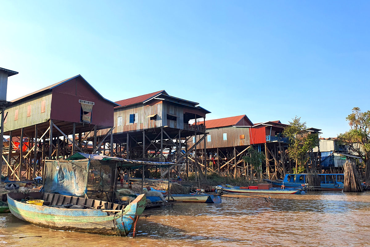
It's the village of fishmen where the houses here are built on towering wooden stilts ranging from 6 to 10 meters high. During the dry season, the stilts stand exposed along dry pathways; during the wet season, the water rises to cover the stilts, transforming the settlement into a floating community accessible only by boat. Surrounding Kampong Phluk is a dense flooded forest . Visitors can take small paddle boats through the submerged trees and mangroves, which serve as vital nursery habitats for fish and local wildlife.
Koh Rong island
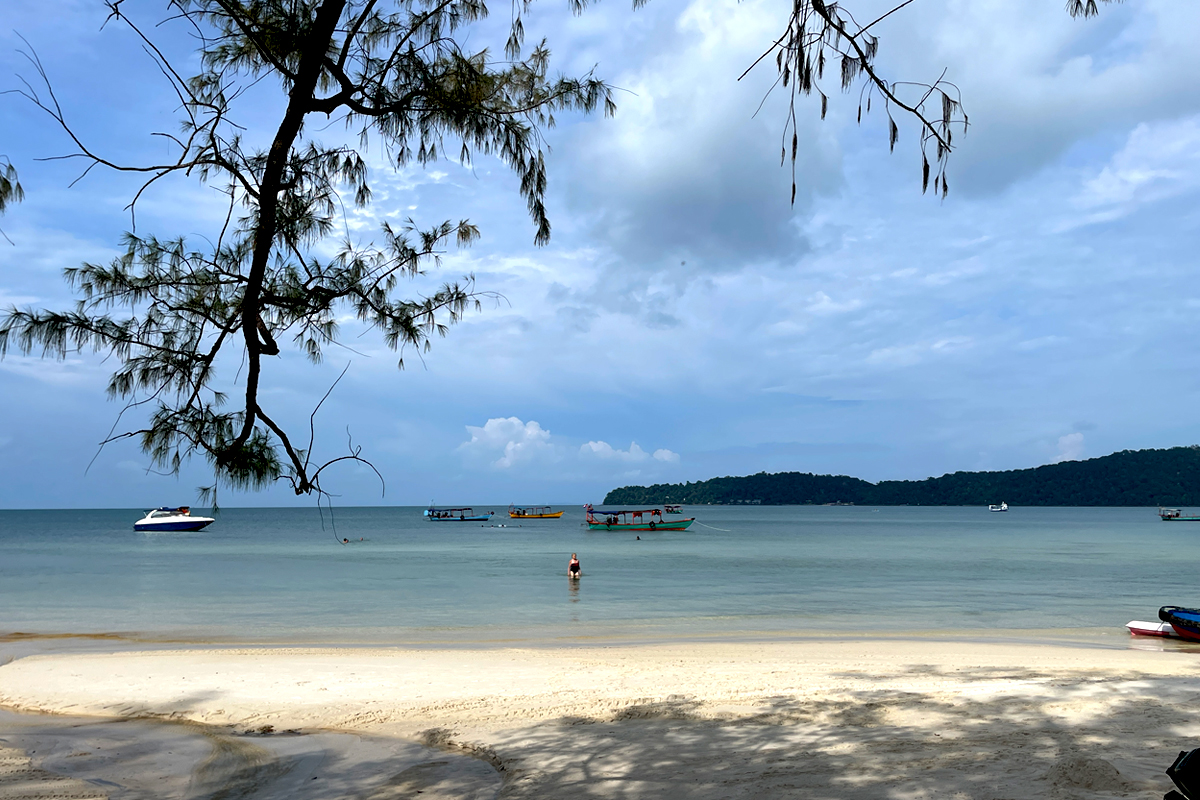
Koh Rong, Cambodia is a tropical island paradise in the Gulf of Thailand, celebrated for its powder-soft white sand beaches, clear turquoise waters, and peaceful environment. Offering a safe and welcoming destination for families, couples, and solo travelers, Koh Rong combines pure island relaxation with exciting discovery. There are 3 principal beaches: 1. Sok San Beach (Long Beach): Stretching over 7 kilometers, this beach features fine white sand and clear waters perfect for long walks, swimming, and sunsets. 2. Long Set Beach (4K Beach): Known for its tranquil atmosphere, powdery white shorelines, and calm, crystal-clear water ideal for swimming. 3. Coconut Beach & Pagoda Beach: Quieter stretches of coast featuring clean shores, gentle surf, and an undisturbed natural atmosphere. Koh Rong has a welcoming community. Locals are warm, helpful, and accustomed to international visitors. Free from major traffic, pollution, and high-rise noise, the island offers a secure space to unplug and relax.
Peung Takou Rock
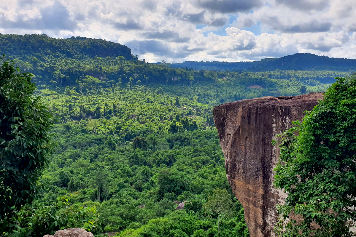
Peung Takou on Phnom Kulen offers one of the most dramatic, sweepingly scenic viewpoints in Siem Reap province. The landscape is defined by its striking geological contrast: a massive, sheer sandstone cliff jutting out above an ocean of dense, emerald rainforest. A sharp, weathered block of natural sandstone protrudes boldly over the cliff edge. Its vertical face showcases centuries of erosion, exposed mineral layers, and dark lichen patches against warm brown sandstone. In the middle ground and background, the terrain rises into steep wooded hills and distant mountain ridges. This layered relief gives the viewpoint its exceptional sense of depth and vast scale. Under bright tropical sunlight and scattered cumulus clouds, the contrast between the sharp sandstone cliff in the foreground and the soft, sprawling jungle horizon creates a perfect natural frame for panoramic photography.

Tatai River
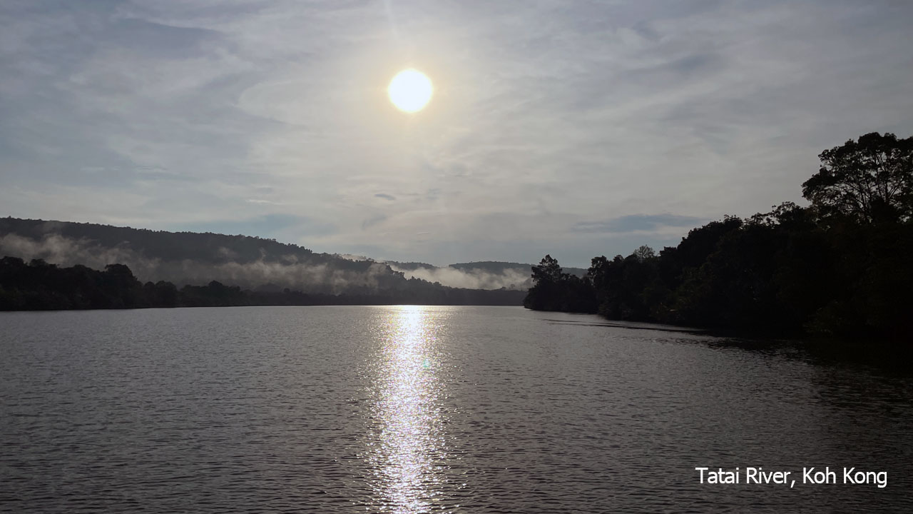
The Tatai River in Koh Kong province is one of Cambodia's most picturesque and ecologically pristine destinations. Meandering through the foothills of the dense Cardamom Mountains, Phnom Kravanh, the region offers an immersive escape into untamed nature. The surrounding evergreen rainforests and mangrove estuaries serve as a critical habitat for diverse species, including pileated gibbons, hornbills, kingfishers, wild boars, fishing cats, and rare freshwater otters. Because the Tatai basin benefits from ongoing conservation initiatives, its waterways remain remarkably clear, feeding downstream into coastal ecosystems. Motorized wooden boats cruise along the wide meanders of the Tatai, taking travelers upriver toward Tatai Waterfall or downstream to explore surrounding mangrove systems. Taking a boat journey at sunrise or sunset offers breathtaking views as mist rises off the water and the peaks of the Cardamom Mountains are cloaked in soft white clouds. Local rangers and community guides lead hikes ranging from easy forest walks to multi-day wilderness treks through old-growth rainforest. Eco-travelers can camp near riverbanks, stay in sustainable tented safari camps, or lodge at low-impact floating resorts anchored directly on the river waters.
Bayon faces
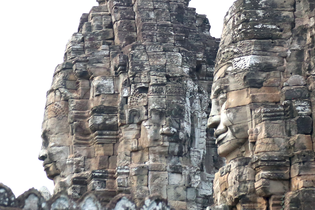
The monumental face towers of Bayon Temple stand as the primary icon of late 12th-century Khmer art and state theology. Built during the reign of King Jayavarman VII, these giant stone faces synthesize royal authority, esoteric Tantric protection, and Pure Land Buddhist cosmology into a single architectural monument.
Angkor Wat
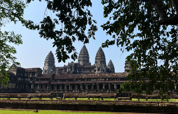
Angkor wat is one of 40 principal temples in Angkor archeological park. It becomes the national emblem of Cambodia as shown in the middle part of Cambodian national flag. Constructed from 1113 AD until 1150 AD on 163 hectares, Angkor Wat is the biggest religious edifice in the world. Not only its amazing dimension, this Hindu god’s residence stores plenty of ancient information through the style of architecture, the iconography and the inscription as well. Since it’s under the Hindu influence, Angkor Wat, built during the king Suryavarman II, inspired the doctrines of the Hindu cosmology, its astrology and so exalted by the mythology. Each measure of length and width follows the duration of Yuga or Mahayuga. For example, the distance of causeway crossing the moat at the west entrance measures 432 cubits (Hath or Arm) which relates to 432 000 years of Kaliyuga.
Prasat Pram
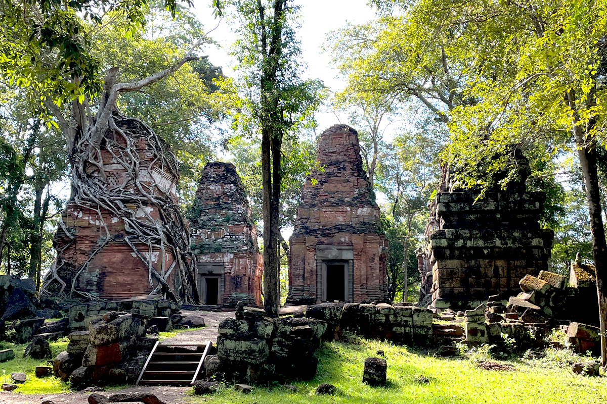
Prasat Pram is one of the hundreds of religious shrines at the Koh Ker site, which extends over 81 square kilometers. This brick structure, consisting of five edifices, was built in the mid-tenth century by King Jayavarman IV and is dedicated to Lord Vishnu. Its location is situated to the south of Prasat Thom, the main temple with a pyramid shape in the center of Lingapura, the city of Shivalinga. Prasat Pram served as a satellite temple, similar to other temples like Prasat Linga in Koh Ker.
Kbal Spean
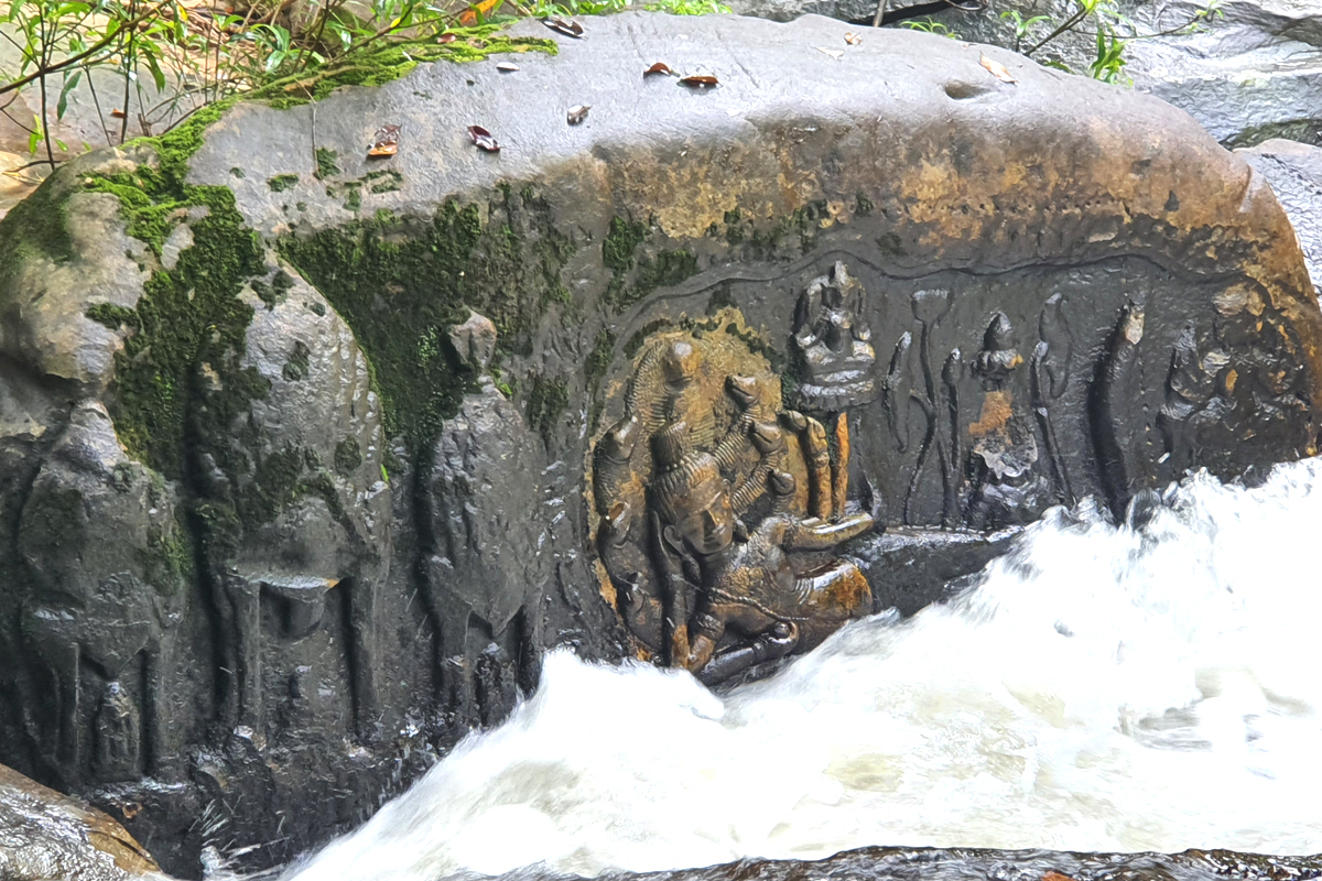
Kbal Spean is an open-air riverbed sanctuary where intricate reliefs were carved directly into the natural sandstone bedrock and boulders of the Stung Kbal Spean River. The carving of the site began during the reign of King Suryavarman I in the 11th century and was completed under King Udayadityavarman II. The riverbed and banks feature hundreds of carved lingas (phallic representations of Shiva) arranged in grid patterns beneath the flowing water, along with depictions of yonis (the sacred feminine symbol). Reliefs depict Lord Shiva seated on his sacred bull, Nandi, alongside his consort Parvati. Reaching the carved riverbed requires an uphill hike through thick tropical jungle along a 1.5-kilometer forested trail. The name Kbal Spean translates to "Head of the Bridge," referring to a naturally formed sandstone rock arch span over the river. Nearby, a small seasonal waterfall flows over the carved stone during and immediately following the rainy season.
Prasat Phnom Cheung Prei
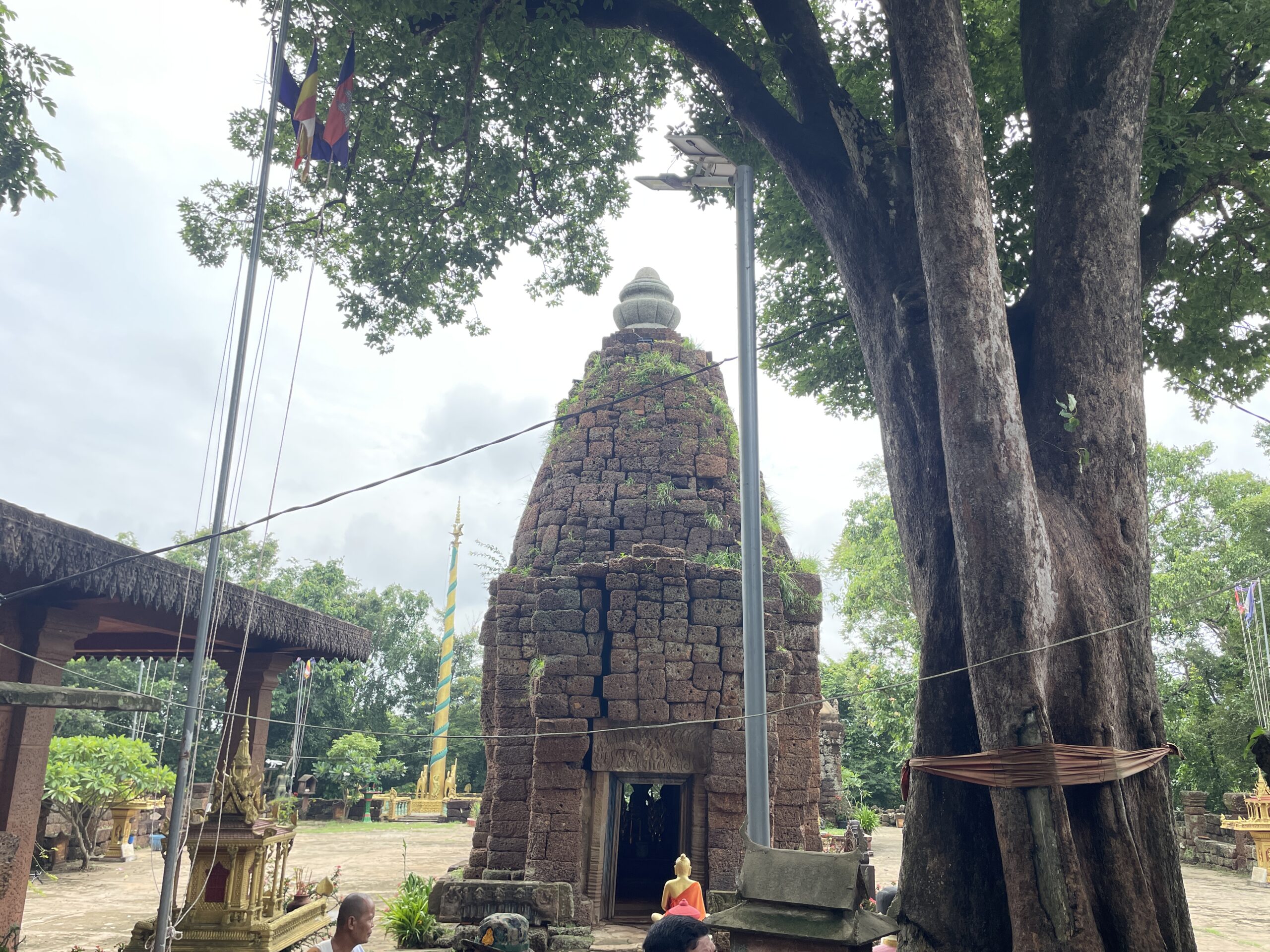
Prasat Phnom Cheung Prei: A Multi-Layered Sanctuary in Kampong Cham Perched atop a isolated hill in central Cambodia, Prasat Phnom Cheung Prei offers a compelling window into the architectural evolution of the Khmer Empire, preserving traces that bridge the early pre-Angkorian era with the height of the Angkorian period. Location & Topography The temple site is located in Kouk Rovieng village, Kouk Rovieng commune, within the Cheung Prey district of Kampong Cham province. Situated north of National Road 6—approximately 3 km east of the Phaav market—the site is reached via a 1,500-meter track heading north. The immediate landscape consists of two distinct hills set about 100 meters apart: Phnom Srei ("Female Hill") / Phnom Thom: The higher eastern hill, which holds the ancient sanctuary. French archaeologist Lunet de Lajonquière originally documented the temple under the name Phnom Thom, a moniker that has since been supplanted by the district's name. Phnom Pros ("Male Hill") / Phnom Preah Bat: The lower western hill. Archaeological & Construction Phases Physical evidence on the hilltop points to at least two distinct periods of major construction, with an intriguing intermediary period. Phase I: Pre-Angkorian Foundation (1st Half of the 7th Century) The earliest sacred activity on the hill dates to the Zhenla period under the Sambor Prei Kuk style. Because pre-Angkorian sanctuaries were traditionally built of brick, the original 7th-century structure no longer stands; however, two fine sandstone lintels survive on-site as diagnostic evidence: Inward-Facing Makaras: Both lintels feature mythic aquatic creatures at their outer edges facing inward, each bearing a small rider. Sagging Arch & Medallions: A lowered arch spans between the makaras, holding round medallions with carved figures, framed by regular festoons, garlands, and dangling pendants underneath. Iconography: One lintel (located inside the sanctuary) depicts a clear bull's head inside a medallion—most likely Nandin, the vehicle of Śiva. This suggests the original pre-Angkorian site was a Śaiva hilltop sanctuary. The second lintel (located outside) features seated figures and a central rider on an eroded mount. Phase II: The Intermediary Period (8th–10th Centuries) No standing structures or securely dated artifacts can be definitively assigned to these intermediate centuries. However, the presence of various uncatalogued lintel fragments and decorated pedestals hints that the site remained active. A complete systematic survey of all loose site stones is necessary to fully document this era. Phase III: Angkorian Reconstruction (11th–12th Centuries) The standing visible architecture on Phnom Srei reflects a major rebuilding project during the classical Angkorian period: Sanctuary Layout: The main tower is a square laterite sanctuary featuring a single interior chamber with active doorways on both the east and west (omitting the usual false doors). The eastern doorway was originally preceded by a brick forebody with pillars, flanked by turned-baluster stone windows. A secondary, small square laterite chamber sits just to the south, opening to the east. Enclosure: The layout featured an outer enclosure wall supported by northern and southern peristyle galleries and a western chambered entrance gopura. Style & Dating: The central lintel depicts a prominent central Kāla (monster mask) crowned by a deity, with foliage branches forming wide downward loops. The absence of makaras and medallions places this carving squarely in the Baphuon to Angkor Wat styles (mid-11th to mid-12th century). Lifting Holes: Many laterite blocks exhibit round transport holes—a quarrying technique heavily associated with large-scale late 12th-century construction (Jayavarman VII era)—suggesting continued building or repair work into the early 13th century.
Phnom Bok temple
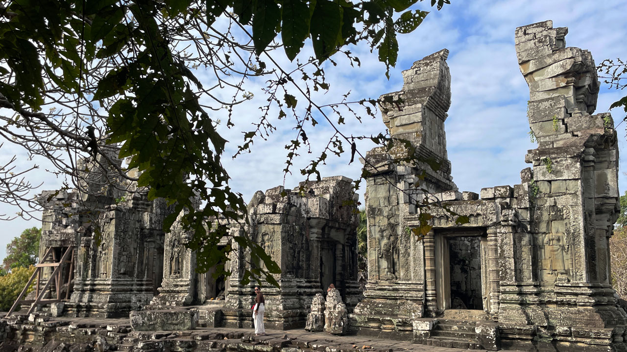
Prasat Phnom Bok (ប្រាសាទភ្នំបូក) is an early 10th-century Hindu mountain-temple located northeast of the main Angkor complex in Siem Reap Province, Cambodia. Positioned atop a 221-meter hill, it is one of the triadic mountain-temples built to mark the sacred boundaries of the new capital established during the reign of King Yasovarman I (r. 889–910 CE). Reign of Yasovarman I (10th Century): As King Yasovarman I moved the Khmer capital from Hariharalaya (Roluos) to Yaśodharapura (Angkor), he constructed temples atop three prominent natural hills: Phnom Bakheng (the central state temple), Phnom Krom to the south, and Phnom Bok to the northeast. Phnom Bok reflects the characteristic Bakheng architectural style, featuring sandstone and laterite masonry with intricate lintel carvings. Epigraphic Evidence (Inscription K.235): According to the Sanskrit and Khmer inscription designated K.235 (found on a stele associated with the site), a high-ranking Brahmin scholar named Rudracarya (a disciple of the royal preceptor Sivasoma) named the sacred mountain Bhadragiri ("Auspicious Mountain"). The inscription details religious endowments, boundaries, and rituals associated with the sanctuary. Dedication to the Hindu Trimurti: Unlike typical state temples dedicated primarily to Shiva as a supreme linga, Phnom Bok explicitly honors the Trimurti—the Hindu triad of supreme deities. The sanctuary layout features three parallel sandstone towers aligned north to south on a single platform: * Central Tower: Dedicated to Shiva * Northern Tower: Dedicated to Vishnu * Southern Tower: Dedicated to Brahma
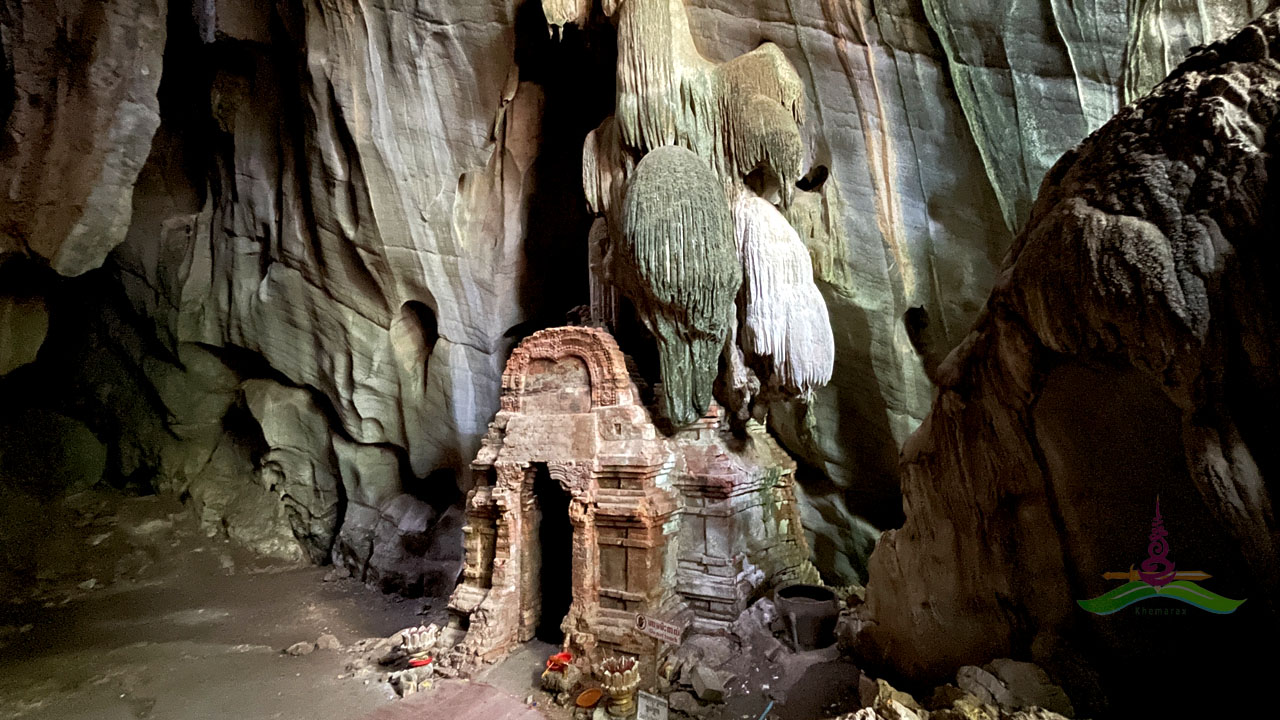
Phnom Chhgnok
Phnom Chhngok (ភ្នំឈ្ងោក) in Kampot Province is one of Cambodia's most remarkable Funan/Chenla-era historical sites, seamlessly blending natural geological formations with early Khmer sacred architecture. The site is set inside a dramatic limestone mountain surrounded by lush rural scenery, rice fields, and pepper plantations.A staircase of roughly 203 steps leads up the hillside and down into a vast subterranean cavern. High above the brick sanctuary, massive stalactites hang from the cave roof. A prominent stalactite/stalagmite formation near the shrine naturally resembles the head of an elephant (Ganesha), which local tradition associates with sacred protective symbolism. The small brick sanctuary inside the cave dates to the 6th to 7th century AD (Funan transition to early Chenla period), spanning the eras from Rudravarman (the last king of Funan, reigning in the 6th century) through Bhavavarman I, Mahendravarman, Isanavarman I, and into the reign of Jayavarman I (late 7th century). Built of exposed red brick without mortar, the sanctuary features characteristic early Khmer architectural elements, including a simple square layout, pilasters, and decorative false doors. Preserved within the sheltered cavern, the sanctuary remains remarkably intact compared to outdoor brick temples of the same antiquity. The sanctuary was constructed directly around a natural stalagmite serving as a self-manifested (svayambhu) Shiva Linga. An inscription associated with the site designates the deity as Śrī Utpannesvara ("The Lord who has Arisen/Manifested Naturally"), emphasizing Shiva's presence arising directly out of the Earth inside the mountain. Beyond its archaeological importance, local villagers continue to use the cavern as an active place of worship and reverence.